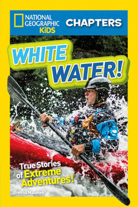
National Geographic Kids Chapters: White Water
From hippo attacks on the Okavango River to Chitina headwaters in Alaska, this chapter book is full of raging rivers and thrilling adventures.With gripping – and TRUE – stories of incredible adventures, extreme excursions, and ultimate survival, White Water! will have you on the edge of your canoe- er seat. Perfect for all readers who love an exciting, real-life, adrenaline-fueled drama.
Читать National Geographic Kids Chapters: White Water онлайн беплатно

Copyright © 2017 National Geographic Partners, LLC
Published by National Geographic Partners, LLC.
All rights reserved. Reproduction of the whole or any part of the contents without written permission from the publisher is prohibited.
Since 1888, the National Geographic Society has funded more than 12,000 research, exploration, and preservation projects around the world. The Society receives funds from National Geographic Partners, LLC, funded in part by your purchase. A portion of the proceeds from this book supports this vital work. To learn more, visit natgeo.com/info.
NATIONAL GEOGRAPHIC and Yellow Border Design are trademarks of the National Geographic Society, used under license.
For more information, visit nationalgeographic.com, call 1-800-647-5463, or write to the following address:
National Geographic Partners
1145 17th Street N.W.
Washington, D.C. 20036-4688 U.S.A.
Visit us online at nationalgeographic.com/books
For librarians and teachers: ngchildrensbooks.org
More for kids from National Geographic: kids.nationalgeographic.com
For information about special discounts for bulk purchases, please contact National Geographic Books Special Sales: [email protected]
For rights or permissions inquiries, please contact National Geographic Books Subsidiary Rights: [email protected]
Art directed by Sanjida Rashid
eBook design adapted from printed book designed by Ruth Ann Thompson
National Geographic supports K–12 educators with ELA Common Core Resources. Visit natgeoed.org/commoncore for more information.
Trade paperback ISBN: 9781426328220
Reinforced library binding ISBN: 9781426328237
Ebook ISBN 9781426328244
v4.1
Version: 2017-10-30
This book is for Liam and Devin, of course. Everything I write, I write for you. —BM

Chapter 1: Scouting the River
Chapter 2: Running the River
Chapter 3: Path to the Pinch
Chapter 1: Signs of Trouble
Chapter 2: Rushing Rapids
Chapter 3: Reading the River
Chapter 1: The Long Haul
Chapter 2: Hippo Attack!
Chapter 3: Land of Plenty


The team rests in a patch of cottongrass after scouting the first portion of the Headwaters Canyon.

Alaska, U.S.A.
Todd Wells was wide-awake. Around him, his teammates snored and mumbled in their sleep. But not Todd. As expedition leader, he had too much on his mind. He had led other expeditions before, but none like this one. Todd and his five teammates were about to try something that no one had ever done before. And it was risky.
Todd’s group was camped in the heart of the Wrangell (sounds like RANG-guhl) Mountains. Their tents were nestled in one of Alaska’s most breathtaking valleys. But they weren’t here to camp. They were here to run the Chitina (CHIT-nuh) River.
“Running” the river means traveling down it in kayaks (sounds like KY-yaks). All six team members were experienced kayakers. Yet this 130-mile (209-km)-long river is unique.
Lower parts of the Chitina River are a favorite among boaters, who take to the river in kayaks, rafts, canoes, and other small boats. But one section of the river had never been run. That’s because until recently, this section was covered in ice.
The source of the river—called the headwaters—comes from the towering Logan Glacier (sounds like GLAY-shur). This massive block of ice flows into the river from the east. The Chugach (sounds like CHOO-gach) Mountains lie to the south. The Wrangells are to the north. A deep canyon cuts between these ranges, and the Chitina runs through the canyon. The first 10 miles (16 km) of the river have always been frozen and impassable.
Over time, changes in the climate have brought about warmer temperatures. The Logan Glacier has been slowly but steadily melting. As a result, this ice has become turbulent (sounds like TUR-byuh-lent), fast-moving water. Is it passable? That’s what Todd and his team had come to discover.
For more than a year, the team had been planning this expedition. They had pored over topographic (sounds like top-uh-GRAF-ik) maps and satellite (sounds like SAT-uh-lite) images of the river. They had talked to local people who had grown up in the area and knew the river well. They talked to other kayakers and boaters who had paddled the lower sections of the river. They had done their homework. But now that they were here, Todd knew he needed to read the river with his own eyes. The best way to do that was from the sky.
After his restless night, Todd asked a local bush pilot to take him up in his small plane. The plane lifted off from a runway in McCarthy, an end-of-the-road town in the Wrangell–St. Elias National Park.
It easily carried them above the Logan Glacier and over the Headwaters Canyon. For the first time, Todd could see clearly what they had been studying. But he wasn’t ready for what he saw.

It wasn’t like looking at a map or a photo. This river moved. A lot. The gray, murky water churned. To Todd, it seemed like a living, breathing beast.