Great Escapes: The story of MI9’s Second World War escape and evasion maps
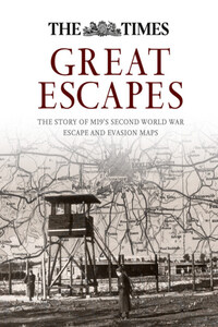
The definitive history of MI9's emergency escape and evasion mapping programme and the contribution the maps made to victory in 1945. Fascinating stories of secret maps used by prisoners of World War II.The creation of MI9 in December 1939, the rationale for the new military intelligence branch and the context of the history of military mapping on silk is outlined. The map production programme is described, together with its progress and the challenges faced. The various groups of maps are identified and described, together with the source maps on which they were based.The ingenious methods of smuggling the maps into the camps, with other escape aids, in apparently innocuous leisure items are described. The maps were then copied and reproduced to support the escapes. Coded correspondence with the camps is discussed, and a successful deciphering of some of that correspondence is provided. The implications for the escape and evasion programme were considerable, but so too were the implications of the passage of intelligence from the camps to aid the war effort, a factor apparently largely overlooked.• Historical Background and the Creation of MI9• The map production programme and the compilation of a carto-bibliography• Escape Aids and Communication with the Camps• Coded Correspondence• Airey Neave and the Schaffhausen Salient• the Baltic ports and maps produced in the camps
Читать Great Escapes: The story of MI9’s Second World War escape and evasion maps онлайн беплатно

Published by Collins
An imprint of HarperCollins Publishers
Westerhill Road
Bishopbriggs
Glasgow G64 2QT
First published 2015
© HarperCollins Publishers 2015
Text © Dr. Barbara A. Bond 2015
Illustrations and Images © see pages
Collins® is a registered trademark of HarperCollins Publishers Ltd
A catalogue record for this book is available from the British Library
All rights reserved under International and Pan-American Copyright Conventions. By payment of the required fees, you have been granted the nonexclusive, nontransferable right to access and read the text of this e-book on-screen. No part of this text may be reproduced, transmitted, downloaded, decompiled, reverse-engineered, or stored in or introduced into any information storage and retrieval system, in any form or by any means, whether electronic or mechanical, now known or hereafter invented, without the express written permission of HarperCollins e-books.
The contents of this publication are believed correct at the time of printing. Nevertheless the publisher can accept no responsibility for errors or omissions, changes in the detail given or for any expense or loss thereby caused.
Source ISBN: 9780008141301
Ebook Edition © AUGUST 2015 ISBN: 9780008165062
Version: 2015-08-27
10 9 8 7 6 5 4 3 2 1
If you would like to comment on any aspect of this book, please contact us at the above address or online:


CONTENTS
Chapter 2 Background to the Mapping Programme
Chapter 3 The Map Production Programme
Chapter 4 Smuggling Maps and Other Escape Aids into the Camps
Chapter 5 Coded Correspondence with the Camps
Chapter 6 The Schaffhausen Salient and Airey Neave’s Escape
Chapter 7 Escaping Through the Baltic Ports
Chapter 8 Copying Maps in the Camps
Chapter 9 MI9 and its Contribution to Military Mapping
Appendices 1–9 Maps Known to have been Produced by MI9: A Carto-Bibliography
Appendix 10 Decoding a Hidden Message
I am indebted to many people for the realization of this long held ambition. To many friends and colleagues in Plymouth University especially Professor Wendy Purcell, formerly the Vice-Chancellor, for her inspiration, belief and confidence, Associate Professor Harry Bennett, Professor Mark Brayshay and Professor Kevin Jefferys for their outstanding scholarship, support and encouragement, Professor David McMullan for sharing his knowledge of cryptography, Tim Absalom and Jamie Quinn for their cartographic expertise, Andy Merrington and Lloyd Russell for photographs; to Peter Clark, formerly the Chief Map Research Officer in the Ministry of Defence, long-time professional colleague, mentor and friend, whose cartographic knowledge and expertise, and willingness to share them, remains undiminished; to Paul Hancock, Brian Garvan and Jim Caruth, former colleagues in the Mapping and Charting Establishment RE (now the Defence Geographic Centre); to the custodians of the many map collections, record repositories and museums I have visited and talked to in my pursuit of the pieces of the jigsaw puzzle, not least The National Archives, British Library, National Library of Scotland, Macclesfield Silk Museum, University of Glasgow, Second World War Experience Centre, Royal Air Force Museum, and the Intelligence Corps Museum; to John E. Bartholomew and the late John C. Bartholomew, Nicola Shelmerdine, daughter of the late Flight Lieutenant John H. Shelmerdine DFC, and Stephen Pryor, son of the late Commander John Pryor RN, for allowing access to family archives; to the late Professor M. R. D. Foot for sharing his experiences and knowledge.
My deepest thanks go to them all.
This book is dedicated to Roger, Abi and Ben, Adam and Johanna, for their love and support.
‘It is the intelligent use of geographical knowledge that outwits the enemy and wins wars.’
(W. G. V. Balchin in The Geographical Journal, July 1987)
This book is the culmination of the author’s personal fascination with maps and charts, and especially with military maps on silk. To be given the task, as a young researcher in the Ministry of Defence Map Library over thirty years ago, of identifying MI9’s escape and evasion maps and creating an archival record set of them was a piece of serendipity. That small task ignited an interest which has never been extinguished. It was, however, only after retirement that the opportunity arose to commit to a detailed and more in-depth study of the subject: the reward was the discovery of a story of remarkable cartographic intrigue and ingenuity, and the opportunity to make this small contribution to the history of cartography in the twentieth century.
During the course of World War II, a complex and daring operation was launched by MI9, a newly formed branch of the British intelligence services, to help servicemen evade capture and, for those who were captured, to assist them in escaping from prisoner of war camps across Europe. Ingenious methods were devised to deliver escape and evasion aids to prisoners, and intricate codes were developed to communicate with the camps. In stories that often appear stranger than fiction, such materials proved critical and made many escapes possible. Maps were an integral part of this operation, with maps printed on silk and other fabrics commonly being secreted in innocent-looking items being sent to the camps, for example in playing cards, board games and gramophone records. The role of maps in this operation has often been overlooked and, because of strict instructions to service personnel at the time not to speak about the maps, the story has remained largely untold.